
GPR DIAGNOSTICS · AFRICA

See beneath the surface before the infrastructure fails.

GeoradarTech inspects roads, railways, airport pavements, buried utilities and concrete structures using ground-penetrating radar (GPR) and other non-destructive methods. Georeferenced data, ready for your maintenance decisions.

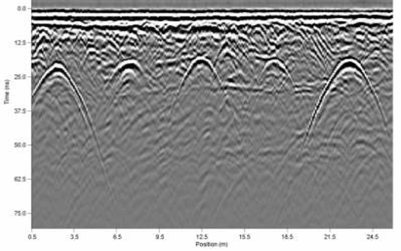
Radargram: a GPR profile showing several diffraction hyperbolas, which correspond to buried objects
Example of a radargram: each arc corresponds to a buried object.
Non-destructive
No coring and no trenching to map the structure.
No traffic interruption
Data acquired at traffic speed along road corridors.
Georeferenced
Every anomaly is positioned in real-world coordinates.
BIM-ready
Deliverables that fit into your models and GIS tools.
SERVICES

Five inspection fields, one method.

01

Roads

Pavement thickness, layer interfaces, voids, potentially wet zones and delamination, over long corridors.

Learn more →
02

Railways

Condition of the ballast and the formation, with standardised indicator reports for network managers.

Learn more →
03

Airport pavements

Structure of airfield pavements and mapping of internal defects, with indicators suited to the ICAO framework.

Learn more →
04

Buried utilities

Locating pipes and cables to secure third-party works and update outdated utility plans.

Learn more →
05

Concrete and structures

Reinforcement, thickness, voids and delamination in slabs, piers and structures, including hard-to-reach areas.

Learn more →

Another need?

Describe your structure or network to us and we will tell you whether GPR is the right method.

Write to us
INDICATORS

Results your teams can prioritise.

The same five indicators for roads and airport pavements, derived from the radar data. Not just radargrams: maps that help prioritise interventions.

01
Structure interfaces
Thickness and continuity of the pavement layers.
02
Voids and gaps
Cavities and compaction defects beneath the surface.
03
Potentially wet zones
Radar anomalies that may correspond to variations in moisture, to be confirmed in context.
04
Buried utilities
Position of pipes and cables within the right-of-way.
05
Prioritisation indicator
Helps rank the sections to inspect first, using a method described in the report.
METHOD

From measurement to a usable model.

01

Acquisition

Field measurement with the radar suited to the structure: vehicle, cart or handheld device.

02

Processing

Signal cleaning, calibration and assisted anomaly detection, checked by a specialist.

03

Interpretation

Reading by a geophysicist and systematic quality control of the results.

04

Georeferencing

Every pick is placed back in real-world coordinates, usable on plans or in GIS.

05

BIM delivery

Maps, indicator reports and models that can be integrated into your existing tools.

IN THE FIELD

From sensor to engineering office.

Manufacturers' demonstration videos, shown for illustration. Our own field footage will be published after our first campaigns.

Watch the video on YouTube Raptor mounted on a vehicle
Mobile road inspection · Raptor 3D
ImpulseRadar video on YouTube, property of its author
Watch the video on YouTube Scanning a prestressed slab with the GP8100
Concrete and structures · Proceq GP8100
AJ Workspace video on YouTube, property of its author
Watch the video on YouTube Mapping buried utilities with the GS8000 Pro
Buried utilities · Proceq GS8000 Pro
ORSCO video on YouTube, property of its author
CONTACT

Let's talk about your network.

Tell us which structure or corridor concerns you. We will reply with a tailored proposal.

Thuringia (Germany)

Your details are used only to reply to your request.